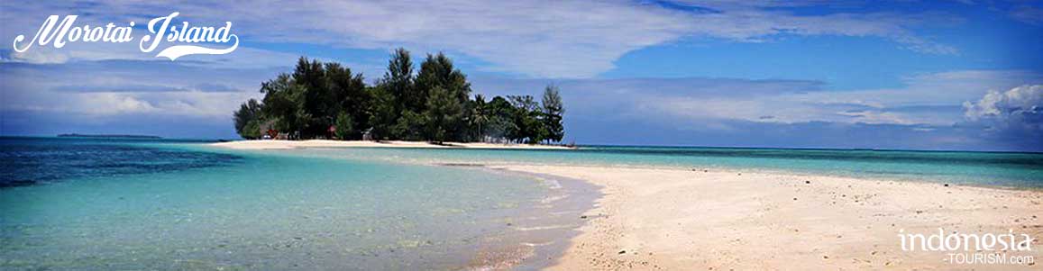
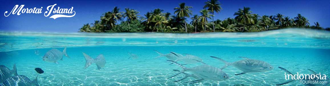
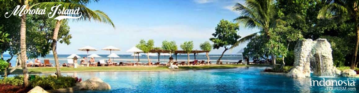
About Morotai
GEOGRAPHIC OF MOROTAI ISLAND
Morotai Island is one of the largest islands in North Maluku, the northern most of Maluku Province, just off the northern tip of Halmahera. The island has the natural resources potential are relatively abundant, both in agriculture, forestry, fishery, mining and tourism potential, especially historical relics of the Second World War. The potential can be used as a primary sector has a good economic value to improve the prosperity of North Maluku in general and especially for Morotai society as well as an increase in foreign exchange for the region.
From the geographical aspect of Morotai Island has a strategic position of Asia-Pacific trade lanes. The geographical position is located at coordinates 2000 to 2040 NL and 128 015 to 128040 EL. As for the administrative boundaries by the district are as follows:
- North: Pacific Ocean
- West: Celebes Sea
- East: Halmahera Sea
- South: Morotai Strait
Morotai Island Regency has an area of 4,301.53 km2, with a land area covering of 2,330.60 km2 and sea area as far as 4 miles area of 1,970.93 km2. With 311,217 km long coastline. Number of small islands of 33 with details of 7 inhabited islands and 26 uninhabited islands
HISTORY OF MOROTAI ISLAND
During the 15th and 16th century, Morotai was under the control of the Sultanate Ternate. The island is the large main area are called Moro included the island and the coast of Halmahera closest to Morotai to the south.
In the middle of 16th century, the island became a Portuguese Jesuit mission. Moslem Sultanate of Ternate and Halmahera offended will pioneer the spread of religious activity and try to prevent the mission from the island in 1571, as a result, the Portuguese leave the region. In the 17th century, Ternate use its power over Morotai by repeatedly ordered the resident to move from the island. At the beginning of the century, its inhabitants moved to Dodinga, a small town on the west coast of Halmahera strategic point. Then in 1627 and 1628, Sultan Hamzah from Ternate ordered the relocation of the Christian population to Malay, Ternate, to be more easily controlled.
As the separated island from Halmahera, Morotai Island natives have settled for generations. Now, residents settled on Morotai came from the Tobelo and Galela tribe in Halmahera Island, precisely in North Halmahera. Both parts (sub-ethnic) dominated the majority of Morotai population until now.
Besides there are two ethnic group (Tobelo and Galela), other ethnic groups who inhabit in Morotai are South Sulawesi, Southeast Sulawesi, North Sulawesi, Java, Sumatra, Maluku China, and others. Some of them get relationship with the local indigenous people and staying there temporarily for a living. The majority of residents of Morotai are Muslims and Christians, a minority of other religions Confucianism, Hinduism, and Buddhism.

Gurabunga Village, Tidore, North Maluku
Gurabunga village is one of tourism village in Tidore Island that interesting to be visited. The name of Gurabunga means flower garden. In fact, this place is being filled with flower that been planted in every corner of the people house. This village has chilling nuance and refreshing air, because it located in 800 meter above sea level. The inhabitants houses are settled in a fertile area at the slope of Kie Matubu Mountain that has 1730 meter above sea level. Kie Matubu is famous in North Maluku as Tidore…
Ternate and Tidore: Where The Cloves Made The History
Since early of the last millennium, the small islands of Ternate and Tidore in the Moluccas were the only source for cloves in the world. Indian, Arab, Chinese and Javanese merchants used to call on these islands to carry home this precious cargo which sold at exorbitant prices in Europe and the Orient. Cloves, together with nutmeg and mace from the Banda islands were used to flavor and preserve food, as medicines and even as aphrodisiacs. But after the Crusades, the trade route to the Far East was blocked for…
Gamalama Mountain, North Maluku
Gamalama Mountain is located in Ternate, North Maluku Province, Indonesia. Gamalama is one of the volcanoes in North Maluku Province. In addition to this mountain, there’s Mount Gamkonora in West Halmahera District, Mount Ibu and Mount Dakona residing in North Halmahera District, and Mount Kiebesi in South Halmahera. Gamalama itself is located on the island of Ternate and has a height of about 1715 m ASL (above sea level). Gamalama Mountain, which is also often referred to as the peak of Ternate, is a stratovolkano, the volcano high and conical,…
Tagalaya Island, North Maluku
In Tobelo, North Maluku, there is a beautiful island which totally promoted by the government; Tagalaya island. The island of Tagalaya is giving cleaning water as glass and natural view like paintings. The beauty of Eastern Indonesia is never get enough to be discuss. We all agree that Maluku have dozen islands and hundred of wonderful beaches. The beach and island in Ambon, Ternate, Halmahera and the others surely can interest thousand tourists to visit and enjoy the natural charming. An island in Tobelo will totally teasing you. Its sea…